Product Details
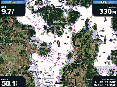
Product Description: Bluechart® G3 Vision Card, New York Plug a BlueChart g3 Vision card into your compatible device's SD™ card slot and tremendously expand its mapping capabilities. High-resolution satellite imagery enhances chart depictions for superior situational awareness so you can navigate with a clear moving-map representation of your boat's position. It's the most realistic mapping display Garmin has ever offered in a chartplotter.
- High resolution satellite imagery, when overlaid on the chart, provides the mariner with unparalleled situational awareness
- Aerial reference photography provides "real world" photos of ports, harbors, marinas, waterways, navigation landmarks and other points of interest, offering the mariner another powerful tool for navigating unfamiliar waters
- Mariner's Eye View perspective provides a bird's eye view from behind the boat showing the chart information for a quick, reliable and easy position fix
- Fish Eye View 3D perspective provides an underwater view that visually represents the sea floor according to the chart's information
- Auto Guidance technology searches chart data to suggest the best passage to a destination
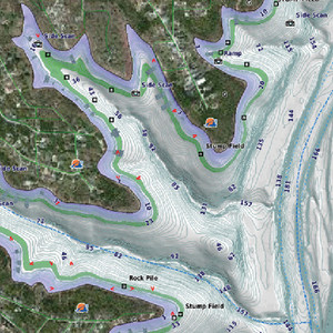
- Fishing charts allow the mariner to hide navigation data from the SD card while leaving the bottom contours and depth soundings for their next fishing adventure
- Includes tides, currents, marine services, coastal roads and points of interest
- Detailed BlueChart g3 maps are include 500, 600, 700, 4000, 5000, 6000, 7000